Quarry Lakes Regional Park - Reclaimed Beauty
- hopalonghiker
- Nov 10, 2019
- 4 min read
Updated: Nov 19, 2019
Accessible Path: Yes (compacted gravel)
Mileage: 3 mile loop

Quarry Lakes Regional Park in Fremont, CA lies along Alameda Creek and is an area that had previously been defined by boundaries. During the Spanish and Mexican periods in California, the creek defined the boundary between two ranchos and Mission San Jose. When California entered the Union, the creek was designated as the boundary between Alameda and Santa Clara Counties. Today, however, the park is helping to reconnect ecosystems and is seen as a shining example of the beauty that can be found in reclaimed lands.
The quarries for which the park is named were established in the mid-19th century and the gravel they produced helped complete the trans-continental railroad. As quarry operations grew, so too did the gravel pits. Eventually, the gravel pits were dug so deep into the water table that water continually needed to be pumped out and into San Francisco Bay. In 1976, these pumping operations were declared to be an illegal waste of groundwater. Quarry operations halted and the land was acquired by the Alameda County Water District. Since then, the land has been transformed from an industrial quarry to an important and vital habitat to migratory birds along the Pacific Flyway. The lakes have become one of the few stretches of near-natural riparian zones along Alameda Creek and has become a temporary home to Great Blue Herons, Snowy Egrets, Wood Ducks and many other water birds.
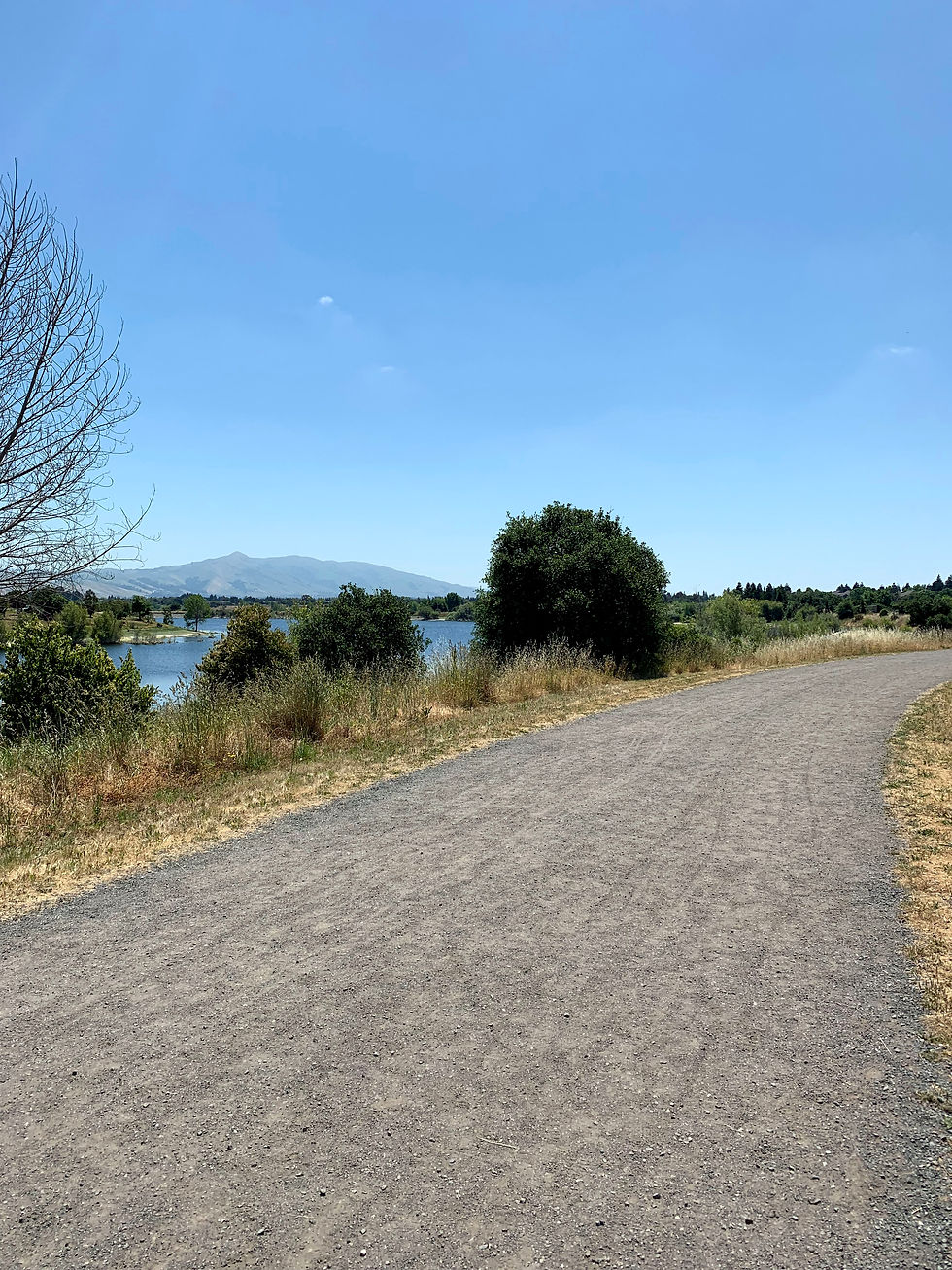
There are many great recreation opportunities in Quarry Lakes, including hiking and biking trails, a white sand swimming beach, fishing and picnicking. The East Bay Regional Park District has even provided a brochure leading you on a scavenger hunt for native plants and trees located throughout the park. A three-mile, low-slope, compacted gravel trail starts and ends at the swimming beach and offers great views of three of the park's lakes and Mission Peak towering beyond.
To begin your lakeside stroll, head through the park entrance and follow signs to the swim beach. After your walk, if you feel like dipping your toes into the water, the park offers beach wheelchairs on a first-come first-served basis. For now, however, follow the sidewalk leading you away from the beach to the Southwest. The sidewalk leads you past an accessible pier and the boat launching facility and you'll soon see the compacted gravel Old Creek Trail.
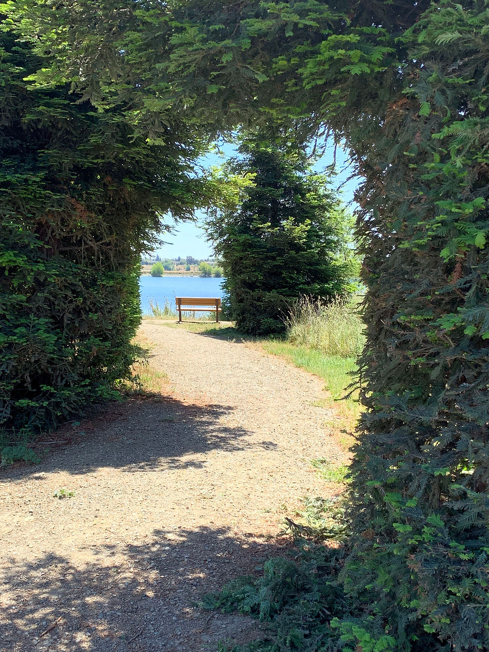
Old Creek Trail leads you along the shore of Horseshoe Lake, offering great views of the lake and hills beyond. To your right are hillside picnic areas; great places to enjoy a snack with a view. After about a quarter mile, you'll come to a junction with another compacted gravel pathway - the Californio Trail. Take this trail to the right, staying close to the water but switching to the shoreline of Rainbow Lake. The Californio Trail passes another accessible fishing pier, and as you follow the trail to the left, great views of Mission Peak.

Continue on the Californio Trail for another half mile, past another picnic area. Be sure to keep your eyes out for migratory birds as well as some of the region's many raptors that call the area home. You'll find the Old Creek Trail once again; take it past the Volunteer Recognition Grove, and you'll quickly find yourself at yet another trail junction. Continue on the Old Creek Trail to the right, catching glimpses of Horseshoe lake through the trees.
The compacted gravel pathway elevates you above two separate lakes: Horseshoe Lake to your left and Lago Los Osos to your right. As you look out over Lago Los Osos, be sure to keep your eye out for wildlife. The lake is a favorite of Canadian Geese, Snowy Egrets and Western Pond Turtles sunbathing on logs. Follow the pathway between the lakes for another half mile or so and you'll find another picnic area, and the Western Pacific Trail.
Take the Western Pacific Trail and continue following the shoreline of Horseshoe Lake. By this time, you've probably noticed a peninsula jutting out into the water - that peninsula is known as Isla Tres Rancheros. This optional, slightly less accessible pathway leads out onto the peninsula and takes you on a 3/4 mile loop through a rare fruit tree grove and past a few picnic areas. The pathway is a little narrower than the compacted gravel and has a few more bumps, but if you're up to it, the walk around the peninsula is a great way to see more of the park.
As you continue past the fork at the peninsula, the swimming beach and your starting point will quickly come into view. If you've worked up enough of a sweat and feel like sticking your toes into the water, stop at the park office and request a beach wheelchair. An accessible pathway lined with roses leads you down to the beach. When you're finished enjoying the cool water, head back up the pathway to the parking lot where you began your journey.


Comments